Projects
Our projects integrate natural hazard modeling, artificial intelligence, infrastructure resilience, and human decision-making to support safer and more resilient communities.
Featured Current Projects
These interdisciplinary projects connect multiple research themes and involve collaboration across engineering, social science, public health, and community planning.
NSF CAREER Award
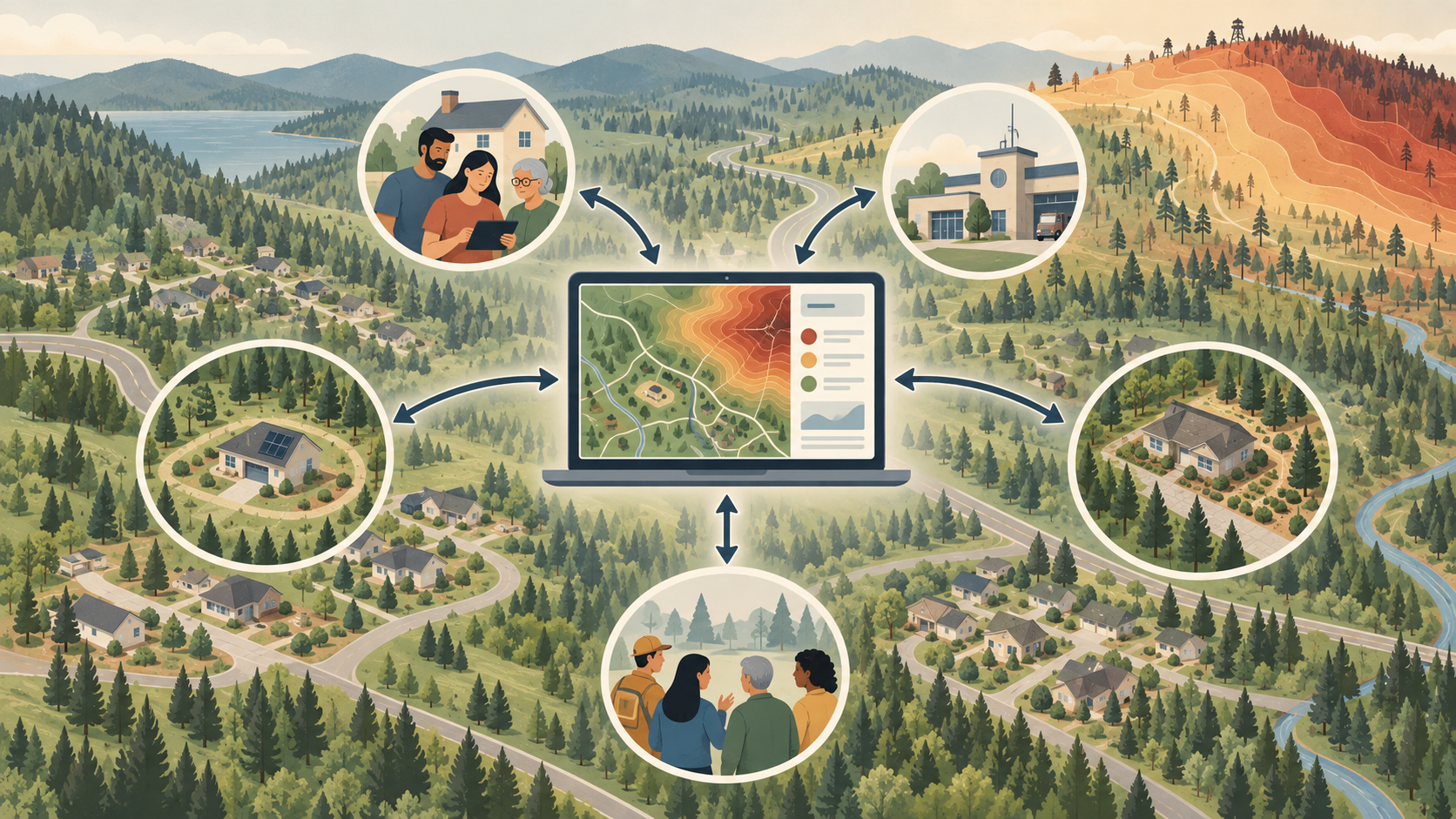
Understanding the Role of Citizen Engagement and Multidirectional Information Exchange in Community Resilience to Wildfires
Citizen Engagement for Wildfire Resilience
This project establishes a dynamic and interactive approach to wildfire risk assessment and management that promotes citizen engagement, multidirectional information exchange, and collective decision-making among community members and local governments.
View project details
Research Problem
Wildfires increasingly threaten people, the built environment, and ecosystems as climate conditions, human activities at the wildland-urban interface, and land-use patterns continue to change. Existing wildfire risk-management strategies often rely on static, outdated, and coarse-scale risk estimates. They also provide limited opportunities for sustained citizen engagement, even though individual mitigation decisions can affect neighboring properties and the broader community. Limited information exchange between governments and citizens creates a barrier to informed and coordinated wildfire-risk reduction.
SHAPE Lab Contributions
- Characterize interdependent wildfire-mitigation decisions between governments and citizens using evolutionary game theory.
- Develop a dynamic wildfire risk-assessment model that incorporates ongoing data collection and processing.
- Examine how citizen engagement and multidirectional information exchange influence individual and collective mitigation decisions.
- Integrate decision and risk models into a prototype next-generation Community Wildfire Protection Plan platform.
- Evaluate the technical feasibility and cost-effectiveness of the prototype platform while incorporating user feedback.
- Translate project findings into educational courses, practitioner training, and public outreach materials.
Expected Impact
The project seeks to advance wildfire planning from traditional static assessments toward a dynamic and interactive process. The resulting approach will help governments and citizens exchange information, coordinate mitigation actions, and engage in collective, risk-informed decision-making. By strengthening collaboration between local governments and residents, the project can help expand responsibility for wildfire-risk reduction from emergency personnel to the broader community.
Relevant Publications
Wang, Z. J., and Lee, J. Y. “From Free-Riding to Collective Action in Wildfire Mitigation: The Role of Policy Incentives.” Expert Systems with Applications, 2026.
- Wang, Z., and Lee, J. Y. “Collective Responsibility in Wildfire Mitigation: Optimizing Subsidies for Enhancing Community Resilience.” ICOSSAR, 2025.
- Rashidi, N., and Lee, J. Y. “Does Resolution Matter? Satellite Imagery Comparison for Dynamic Fuel Mapping and Wildfire Risk Assessment.” ICOSSAR, 2025.
Wildfire-Resilient Power Grid Infrastructure Planning: Socio-Technical Innovations for Energy and Health Equity
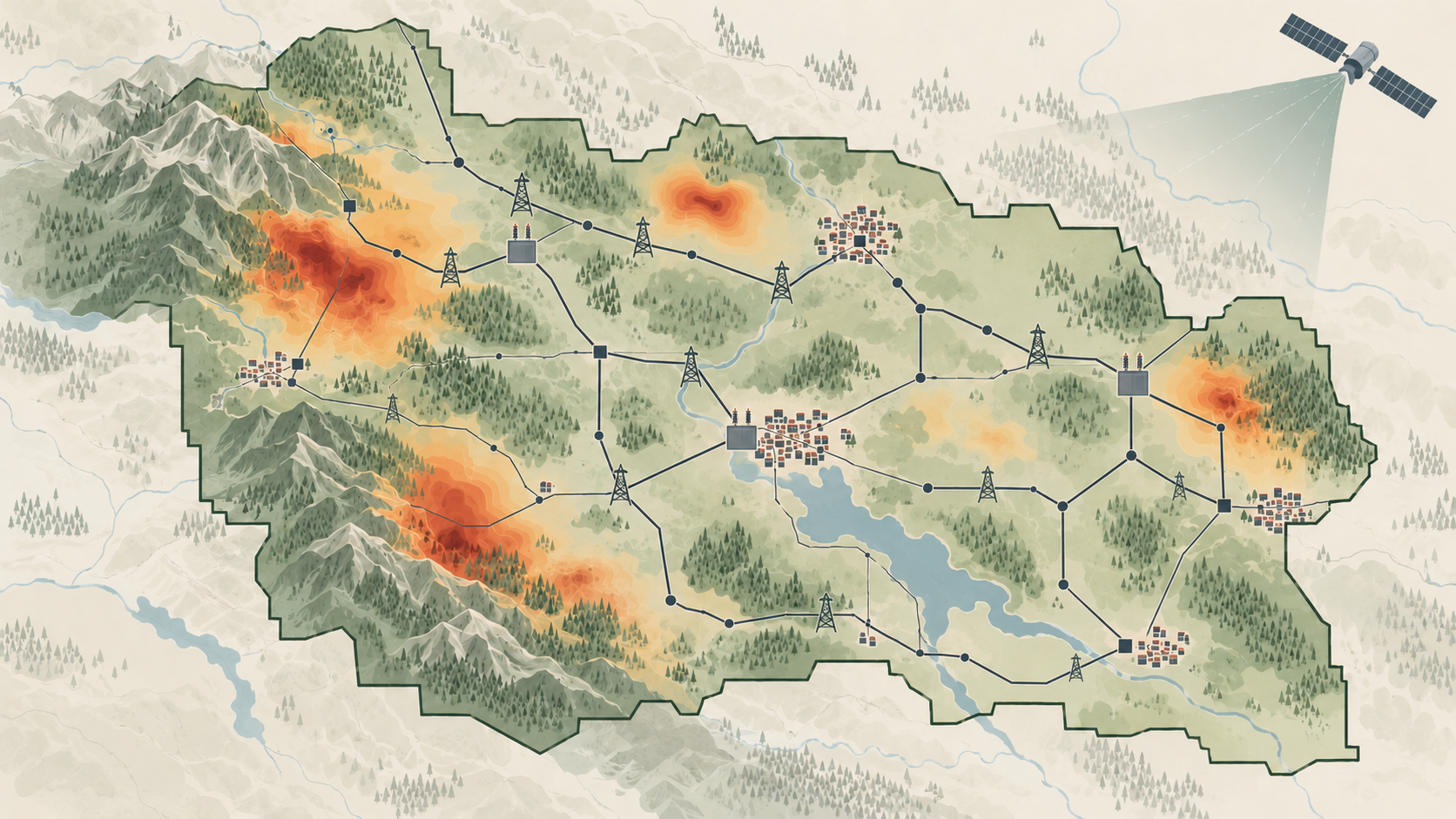
Wildfire-Resilient Power Grid Planning
This project establishes a community-focused Power Grid Wildfire Resilience Planning (PG-WiRePlan) framework that mitigates wildfire-related power outage risks while identifying and incorporating the energy- and health-related needs and values of diverse stakeholders through community engagement.
View project details
Research Problem
Wildfire-related power outages can significantly affect people, businesses, and communities in different ways. This project brings together key partners, including utility companies, ratepayers, regulators, local agencies, and health and energy organizations, through a community collaborative. We study wildfire-related outages, develop actionable solutions, and establish a more effective and balanced resilience planning framework.
SHAPE Lab Contributions
- Model wildfire ignitions across diverse landscapes, community settings, and ignition sources.
- Build an advanced wildfire simulator for regional-scale risk assessment.
- Create a cluster-based active-learning scenario reduction framework for probabilistic wildfire risk assessment.
- Predict wildfire-related power outages using satellite imagery.
- Evaluate community-centric solutions using an interactive dashboard currently under development, which will display the spatial distribution of benefits, costs, and burdens associated with different resource-allocation choices across the service areas of our utility partners.
Broader Project Collaboration
The broader multidisciplinary project team contributes complementary expertise in wildfire modeling, power grid resilience planning, public health, and community engagement.
Expected Impact
The project will help utility and community partners compare resilience strategies and understand how the benefits, costs, and burdens associated with different resource-allocation decisions are distributed across utility service areas. The resulting framework will support technically sound and community-informed planning for wildfire-related power outages.
Relevant Publication
Jonnalagadda, V., Lee, J. Y., and Sanad, A. A. “Cluster-Based Active-Learning Scenario Reduction Framework for Probabilistic Wildfire Risk Assessment.” ASCE-ASME Journal of Risk and Uncertainty in Engineering Systems, Part A: Civil Engineering , 2026.
Advancing Community Wildfire Preparedness through AI-Driven Personalized Evacuation Coordination Plans
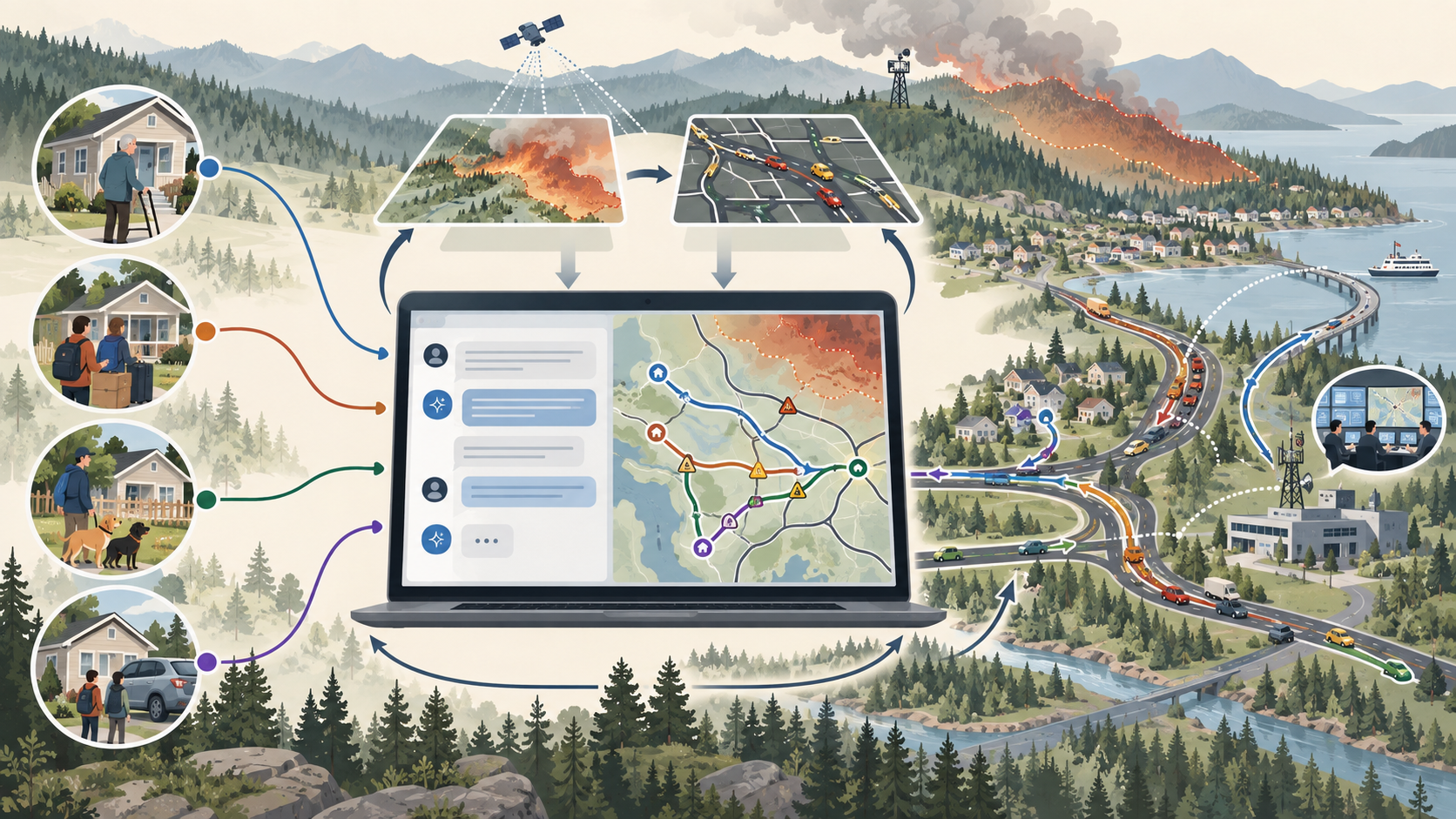
EVAC-Advisor: AI-Driven Wildfire Evacuation Planning
This project develops EVAC-Advisor, a customizable, human-centered, LLM-based system that helps residents and emergency managers co-design personalized wildfire evacuation plans while balancing individual household constraints with broader community safety goals.
View project details
Research Problem
Wildfire evacuations are becoming increasingly difficult as fires become faster and less predictable. Existing evacuation guidance often provides standardized instructions without accounting for household-specific needs, road capacity, visitor populations, transportation limitations, livestock, mobility challenges, or traffic congestion. As a result, current approaches do not adequately balance individual constraints with broader community safety goals. This project addresses that gap through a customizable, LLM-based co-planning tool that grounds personalized recommendations in local wildfire and transportation data and iteratively balances them with network capacity and community-level safety.
SHAPE Lab Contributions
- Develop an LLM-driven interface that helps residents create personalized evacuation plans based on their household needs and constraints.
- Use retrieval-augmented generation to ground AI recommendations in local road networks, parcel information, wildfire data, refuge areas, and emergency-planning protocols.
- Adapt EVAC-Advisor responses to different levels of user trust, technical knowledge, and skepticism toward AI-generated guidance.
- Develop a simulation-based optimization engine that balances personalized departure times, routes, destinations, and shared-mobility needs with community-level evacuation goals.
Broader Project Collaboration
The multidisciplinary project team combines wildfire modeling, transportation simulation, optimization, artificial intelligence, emergency planning, and social-science methods. Focus groups and cognitive interviews with residents, fire professionals, emergency managers, land-use planners, and other local stakeholders will support the co-development and evaluation of EVAC-Advisor.
Expected Impact
EVAC-Advisor will help residents and emergency managers establish personalized and coordinated evacuation plans before wildfire emergencies. By balancing household needs with network capacity, shared mobility, and clearance time, the system aims to improve community evacuation efficiency and safety.
Other Active Projects
Advancing Strategic Traffic Enforcement Planning through Behaviorally Informed and Spatially Explicit Modeling
U.S. Department of Transportation Tier 1 University Transportation Center for Healthy and Durable Transportation (CHDT)
This project develops a behaviorally informed, exposure-normalized, and spatially explicit framework for allocating traffic enforcement. By linking enforcement strategies to driver behavior and crash reduction, the resulting decision-support tool will identify corridor-level enforcement intensities that maximize injury reduction under budget constraints.
Project Leadership: Ji Yun Lee (PI); Zhujun Wang (Co-PI)
Enhancing Timber Supply Chain Resilience for Post-Wildfire Reconstruction through Multimodal Mobility and Collaborative Stakeholder Coordination in the Pacific Northwest
U.S. Department of Transportation Regional University Transportation Center, Pacific Northwest Transportation Consortium (PacTrans)
This project develops a cloud-based coordination system to strengthen timber supply chain resilience for post-wildfire reconstruction in the Pacific Northwest. By monitoring disruptions and coordinating timber movement across road, rail, and maritime transportation, the system will support flexible resource deployment and a more responsive post-wildfire logistics network.
Project Leadership: Ji Yun Lee (PI); Zhujun Wang (Co-PI)